
The journey West began at the boat yard in Annapolis, Maryland. The local riggers hopped on board and got to work. They pulled the mast out, hauled her up in the air, pulled off the rudder and then spent about two hours cajoling the 9000 lb keel off of her. About 20 people gathered around to watch. And there was a lot of suggestions from the peanut gallery on how to best coax it off. Vernon and I stood silently by like we were nervously waiting for our first grandchild to be born. Nothing you could do but watch. It finally came.
_Moment")


 Once the trucker arrived they loaded Encore on the trailer and secured it in place.

 Vernon and I get a Penske truck and loaded the big dinghy, outboard motor and other awkward, heavy things in the back. This is our ride for the trip west. The trucker will have to take his oversize load down approved height highways and get permits for every state he travels through- usually only traveling by day, with some states restricting travel on Sundays. It will probably take him and the escort truck 12-14 days to travel from Annapolis to Marina del Rey. Our only restriction is the turn in date for the Penske rental. We have 7 days to cross country and see some sights along the way. After looking at all the options we head out early Friday, Oct 13th.
Day 1 – Start in Annapolis, Maryland and drive to Shenandoah Mountains National Park in Virginia. The trees are beautiful and we are greeted by deer along the road.

But as the park ranger warned us, there is fog obstructing any view points.

The drive through the winding mountain roads is still pretty and a great starting point headed west.


DISCLAIMER: The majority of pictures on this trip are taken as we drive along, through the bug splotted reflective windshield. Vernon tries to accommodate my photos, but it is hard driving a big truck with no pullout space on highways and according to him if he stopped every time I wanted to take a picture, we would still be in Maryland.
So it is on to West Virginia where we drive along and through the Appalachian mountain range. The leaves are changing for fall and the colors are beautiful and I can’t get that John Denver song out of my head: West Virginia, mountain mama, country roads, take me home. 
 Now I have to tell you something about traveling with Vernon and me. We look up everything that catches our fancy. We google the history and geology of everything we pass. Whoever isn’t driving reads the information. So of course I can give you some interesting facts about our sights. The Appalachian mountains were once as tall as the Alps. They were formed with the collisions of plates with the Supercontinent Pangaea (400+ million years ago). Then of course they eroded down as Pangaea broke apart. When you read the geologic stuff it makes you realize how very little time man has been around.
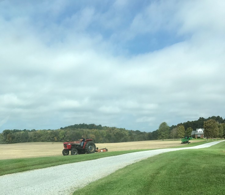
Leaving West Virginia we enter Kentucky: The Bluegrass state (and some of the rolling farms did have blue tinted grass!). We end day 1 at Frankfort, Kentucky.
Day 2: We get up and figure since we are in Kentucky it would be a shame not to check out the Bourbon Trail.  So we drive to Maker’s Mark and have a wonderful tour and tasting.


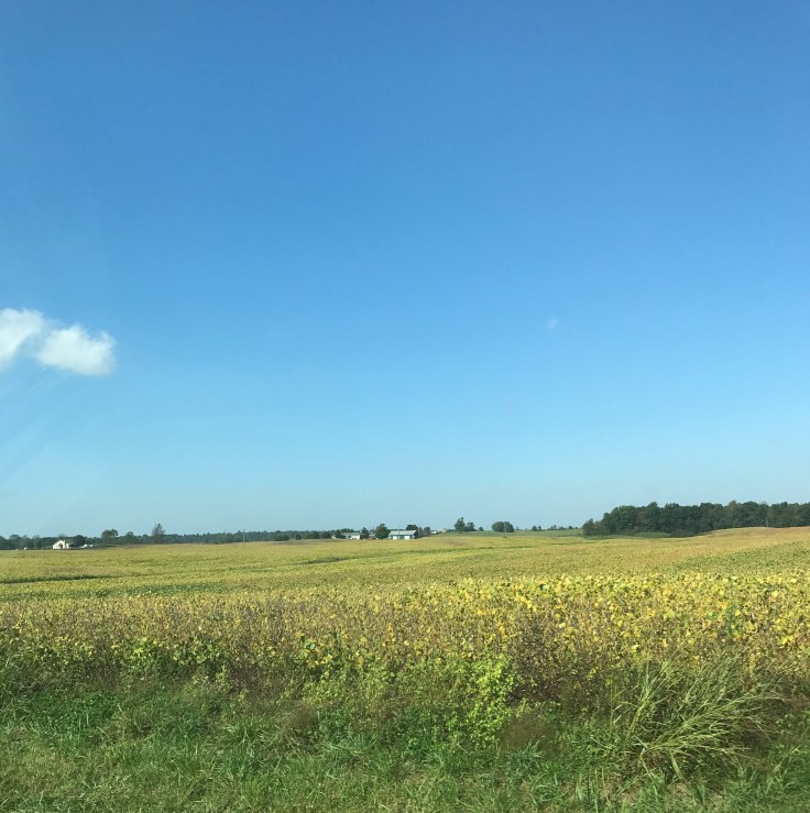
We continue our drive through the countryside of Kentucky and into Tennessee.
The farms are spread apart but most have pumpkins and fall decorations out and many have really elaborate Halloween displays.  I feel sorry for the kids trying to fill their bags trick or treating when the homes are spaced so far apart.
At the end of the day we arrive in Memphis, Tennessee. I know we should have found a local BBQ joint and had some pulled pork or Tri tip. But I was tired and iHop was right next to the hotel. I had pumpkin pancakes! Yummm.
Day 3: A long day of driving and trivia. So be prepared to get schooled. We get on the road early (reminds me of sailing trips), cross the Mississippi River into Arkansas and stop for gas and coffee just before it starts to rain and we are held up by a jack knifed FedEx truck on the highway ahead.


We read about Arkansas -second poorest household income state. Well then you ask—who is the poorest (Mississippi) and who is the richest (Maryland) and how do the other states or countries rank? Google it! After about an hour we are moving again. We watch the fields of sorghum, hay, cotton and soybeans.

And soon we are in Oklahoma–Indian territory. Which prompts hours of googling on Indian history and what tribes were in different areas of the USA and where did they get relocated to, etc. We pass different reservation signs and learn about the lifestyles of the tribes. Amazing information at my fingertips, until it isn’t because my cell reception drops. Definitely the American natives got the short end of the stick when the Europeans came ashore.
We move right on into Texas and see cattle ranches so I read about cattle raising and open range vs. feed lots and Temple Grandin’s work. I see a ton of wind turbines dotting the ranch and farm lands. They are about 460 ft tall with blades 60 yards long. This clean energy source offsets its installation cost (about $55K) quickly and produces about 16 billion kilowatts of energy in the US per year.


We learn that we are on roads that are part of the old Route 66 path. Route 66 was one of the original US highways. We pull off Route 60 to get gas and see an old Conoco station preserved from the old popular Route 66 that crossed the US from Chicago to Santa Monica. And we see the sign for the Big Texas Steak House where you can still get a 72 oz. steak meal free if you can eat it in under an hour.


But we pass on that offer and pull into Amarillo to spend the night.
Day 4: We get moving early and drive on to New Mexico. More open country but the landscape is changing. High desert describes it best. Lots of wide open sky, barren mountains and scrub brush.  We stop in Albuquerque and get some groceries and head on up to Colorado. Vernon drives us up the windy road to 7000 feet elevation and Mesa Verde National Park.


Where we check into our room with a view and have a picnic on the balcony as the sun sets over the desert mesa top.


Day 5: MY BIRTHDAY! and I wake up to this gorgeous view (and Vernon too!)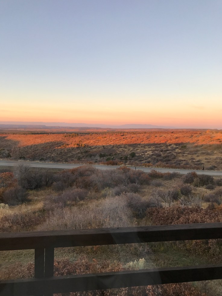
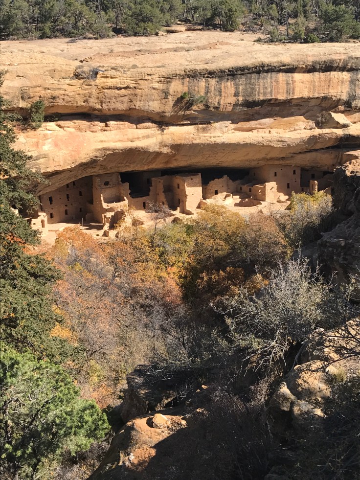
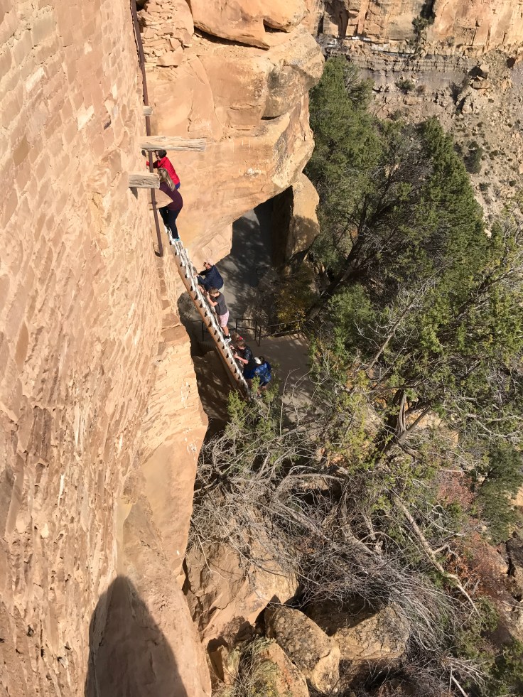
We grab some coffee and hurry on over to our tour of the Park and its Pueblo ruins. This mesa (really a cuesta) was home to Pueblo Indian peoples for over 600 years (till about 1200 AD). They built pit houses on the mesa top then started building cliff dwellings in the limestone overhangs in the caverns. The sites are amazingly preserved and we were able to walk and climb and crawl through Balcony house. If you have never been to this national park, you should go.


Day 6: We head over to Arizona and the Grand Canyon National Park! Another must see in this world. I have been to the Grand Canyon numerous times but never stayed IN the park. We arrive about 1 pm and enjoy stopping at all the overlooks as we enter the park. 
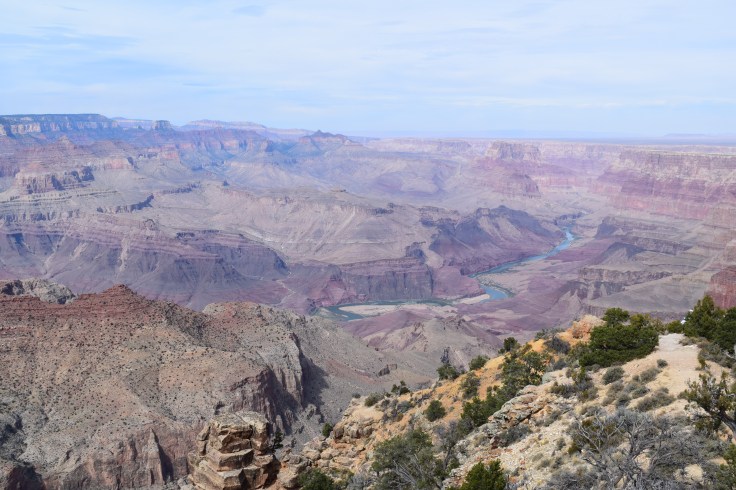
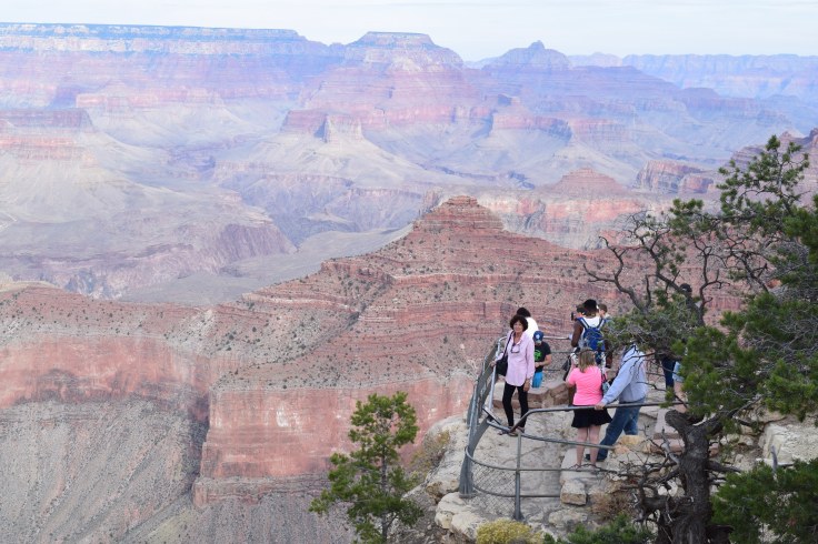 We are on the south rim and after checking into our hotel we hike over to the geological center to hear a ranger talk on the park’s geology. This ranger did such a great job explaining the eons of time that the earth has gone through to create such a masterpiece.
 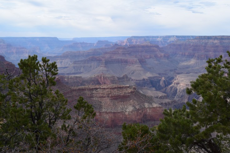 The pacific tectonic plate went deep —pushing up this area as an even plateau. Then the Colorado river did its work over 5-6 million years, exposing nearly two billion years of Earth’s geological history. The result is stunning. As we sit and listen to the ranger you can see dozens of people climbing out on precipices to get the perfect selfie. Immediately I wonder how much the accidental death volume has increased here since the smart phone selfie!
Day 7: Last day and we head west one more time driving to the California border.  We pass some strange rock formations in this barren desert country.


To pass the time, I make Vernon list all the states and which states touch the borders of each one. He does pretty good. We drive on through the Mojave desert and into Southern California – we take 55 all the way to PCH and head up the coast past Huntington Beach Pier 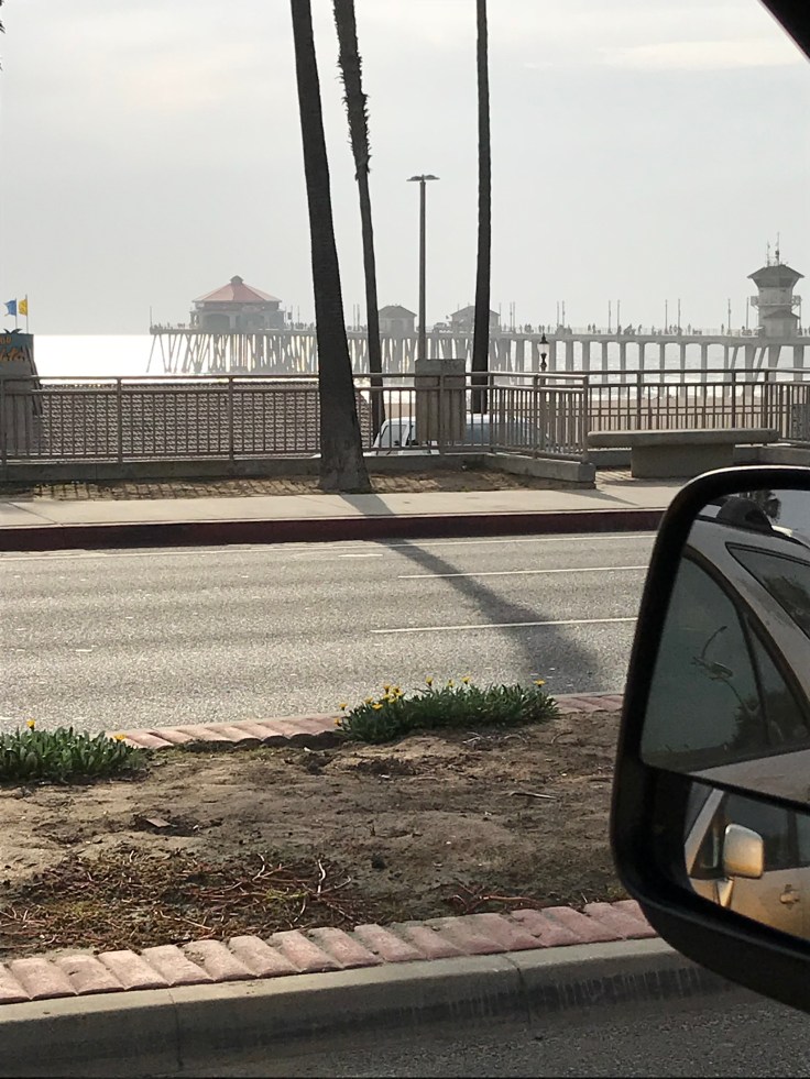 and on to Long Beach and my daughter’s home. It is bittersweet to be here. I so wish that we could have been on our way to the US Virgin Islands right now but understand that it wasn’t possible. So we will play around this area for a while. Once the boat arrives.
So to sum it up:
7 days driving in a Penske truck
3360 miles on US highways and country roads
12 states from Maryland to California
And can you believe it???? 61 amazing years I have had ….. SO FAR
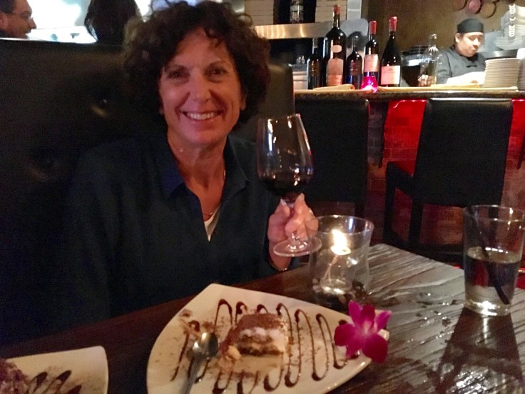
Cheers!

October 22, 2017 at 4:27 pm
Happy late birthday, Terri! You totally rock 61, Girl! Here’s to decades more and continuing your amazing adventures. Thank you for taking us along!
LikeLiked by 1 person